14055 | |

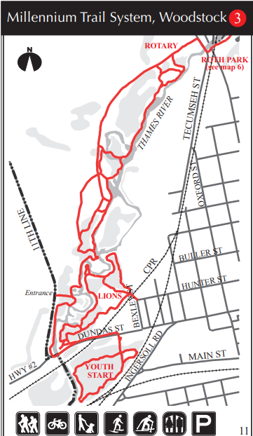
Millennium Trail System - 6km or less

 The Millennium Trail System includes trails developed by the City of Woodstock, Woodstock Rotary Club, Woodstock Lions Club and Youth Start and is maintained by the City.

Discover the Millenium Trail System

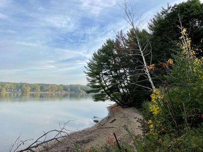
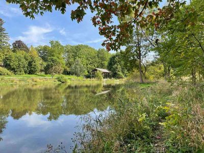
The trail follows the banks of the Thames River, through mixed hardwood and softwood forests, marshland and some retired agricultural areas, some of which are slated for reforestation.

Hikers may spot the occasional deer, beaver, blue heron and other interesting wildlife. Blackberries may be ripe for the picking. Though the trails are not connected, they are in close proximity to each other.

Length: Rotary: 5.9 km, Lions: 1.72 km, Youth Start: 1.40km (loops)

Difficulty: Easy

Facilities: Parking, outdoor toilets, benches

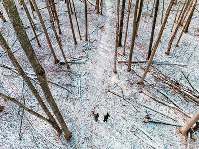
Trail Uses: Hiking, cycling, cross-country skiing, birding, snowshoeing (No Motorized Vehicles)

Primary Surface: Gravel

Access Locations

  • Rotary Trail: North on Hwy 59. Immediately after crossing the bridge over the tracks and Thames River, turn left onto Tecumseh St. (Oxford Rd. 48). The trail entrance is on the right.
  • The Roth Park Trail starts on the other side of Tecumseh St., across from the Rotary Trail. Another entrance is on the east side of the 11th Line, ½ km north of Hwy 2.
  • Lions Trail: Take Hwy 2 (Dundas St.) to the west end of Woodstock. The trail entrance is on the north side of Hwy 2, 200 metres west of the railway bridge. Another entrance is at Bexley and Hunter streets, at the railway overpass
  • Youth Start Trail: Take Hwy 2 (Dundas St.) to the west end of Woodstock. The trail entrance is on the south side of Hwy 2, 60 metres east of the railway bridge.

Open: All year

How can I help keep Oxford County beautiful and healthy?

Bring along your favourite reusable water bottle. Leave all places in a better state than when you arrived. Give wildlife space; even if animals do not run away from you, they may be protecting young. Provide adequate space for flora and fauna. Take in the changing terrain, stay on the path and avoid them during wet/muddy periods. If the parking lot is full at the trail you're visiting, consider coming back at a different time or choosing a different trail to avoid overuse. Finally, take only photos and leave only footprints. If you'd like to give back, you can consider purchasing a tree.

What other trails are nearby? What trails are over 5km?

Nearby trails in and around Woodstock include the Roth Trail, Hickson Trail, Sliver Trail and the Herbert Milnes Trail. If you’re looking for a trail 5km or over, we have: Wildwood Trail (25km), Avon Trail (19km), Hickson Trail (9km), Roth Park (12km), Sliver Trail (5.25km), The Carroll Trail (5km) or the Trans-Canada Trail (17km). To learn more about these trails, check out our Trails and Hiking Page .

How far is this trail system from downtown Woodstock?

Not too far at all. It’s about a 5-minute drive from the main access point.

Where can I grab a bite nearby?

Check out our blog post on A Food Lover’s Guide to Woodstock.

Contact Information

City of Woodstock
(519) 539-2382 Ext 4101

Map

Roth Park - 12km
Roth Park is on the south side of Pittock Lake. There are picnic facilities and is home to the Woodstock...
Thomas Ingersoll Scenic Trail - 2km
This beautiful walk brings you from the Ingersoll Cheese Museum into downtown Ingersoll. Discover the...
Trillium Woods - 1km
Be delighted by this easy trail during any season. Discover Trillium Woods This wide, well-maintained...
The Carroll Trail - 5km
Full of beautiful vistas and bridges to cross, there is an opportunity to see wildlife as well as some...

Trip Ideas

7 Must Trek Hikes Through Oxford
Lucky for us, Oxford County is located in the heart of Ontario's lush Carolinian Life Zone which means...
7 Oxford Trails to Get You Outside this Winter
7 Oxford Trails to Enjoy in Winter Fresh air, brisk temps and time in Mother Nature make winter so much...
Hikes & Hamburgers: Match up your next great hike with a hearty meal in Oxford County
1. The Trans Canada Trail + The Indigo Lounge For the hike: Tillson Ave, Tillsonburg ON (just south...
3 Hiking Trails in Southern Ontario: Get off the beaten path in Oxford County
Where Should I Hike? So...you want to get outdoors, eh? If you're looking for a quiet hiking trail in...